Decatur 2010 Comprehensive Master Plan
Adopted April 27, 1999
Executive Summary
Decatur 2010, Comprehensive Master Plan
The 2010 Plan is a comprehensive master plan that highlights and projects Decatur’s growth from its inception 191 years ago through the year 2010. The Planning Department compiled the 2010 Plan as an “official public statement” of growth management and developmental policies for the future of the City of Decatur. The 2010 Plan is the policy guide for meeting the goals the community wishes to achieve as it moves into the future. The policies are designed to guide both public and private decision-makers in such a way that their decisions will contribute toward the realization of the type of community the citizens of Decatur want.
A portion of the 2010 Plan also represents information gathered from nineteen neighborhood meetings conducted by the Planning Department and the City of Decatur Planning Commission members between September 1997 and March 1998. These meetings allowed the citizens of Decatur to voice their concerns about Decatur’s growth and future needs. Input from many civic groups, elected officials, public hearings and work sessions was also part of the information gathering process.
This summary will identify and briefly address the following aspects of growth management. These are addressed in further detail in the Decatur 2010 – The Comprehensive Master Plan for Decatur, Alabama, Chapter 2.
- Identification of Growth Issues (e.g. education; quality of life; transportation; public improvements; community facilities; fiscal management; land use management and technology).
- Historical Beginnings
- Natural Environment
- Population and Economy
- Housing
- Neighborhood Study Areas
- Land Use
- Transportation
- Community Facilities
- Implementation – Growth Management
Growth Issues, Policies and Recommendations
Growth issues were identified through various meetings with neighborhoods, elected officials, and civic groups. The Planning Commission will focus on these growth issues when they make their annual report and recommendations to the Mayor and City Council. Implementation of these plans will become part of the “strategic planning process” for the City of Decatur. A summary of the major growth issues follows:
- Education – maintaining and updating the existing educational facilities; coordination of future school sites in developing neighborhoods
- Quality of Life/Aesthetics – development of cultural arts center; renovation of the Princess Theatre; maintaining and enhancing the livability of all neighborhoods; development of a landscaping ordinance; completion of a comprehensive forestry plan, provide aesthetic improvements to Decatur’s major intersections and entranceways
- Transportation – completion of the Southern Bypass to connect Red Hat Rd./Mallard Fox Industrial Park to I-65; completion of Beltline Frontage Road Plan and six-laning the Beltline. Priority is given to “local streets” in major growth areas: Spring Avenue; Danville Rd.; Modaus Rd.; Old Moulton Rd.; and Central Parkway. Completion of major segments e.g. Spring Ave. to Day Rd. before moving to Danville or Modaus Roads.
- Other Public Improvements – Extension of sewer to outlying areas; revitalization of older commercial areas; development of a comprehensive storm water management plan for the entire city; provide police community resource centers, and construction of fire stations in Study Areas 1 and 8.
- Fiscal – Adopt a 5-yr. capital budgeting and improvements program for the City
- Parks and Recreation – Purchase sites for three additional regional parks south of Beltline Highway; construct city-wide pedestrian bikeway path that connects existing neighborhoods; construct a community park and recreation center south of Beltline Highway.
- Land Use Management – provide additional industrial acreage; preserve neighborhoods through strict code and zoning enforcement; protect Wheeler Wildlife Refuge; develop village commercial district with revision to the Zoning Ordinance
- Technology – Implement Geographic Information System (GIS) to network all municipal service providers – “growth management” analysis and implementation.
Historical Beginnings
A chronological summary of the historical growth and development of Decatur, Alabama is detailed in Chapter 3 of Decatur 2010 – The Comprehensive Master Plan for Decatur, Alabama.
This summary represents 191 years from “cotton bolls and riverboats to steel coils and rocket boosters.” Decatur’s historical development has been intrinsically linked to the Tennessee River, the railroads, and industrial development and these are a major focal point of this chronology.
Natural Environment
Chapter 4 gives a general overview of the natural setting of Decatur and its surrounding areas.
Decatur is located in North-Central Alabama in Morgan County and is bordered by the Tennessee River on the north, Cullman County on the south, Marshall County on the east, and Lawrence County on the west. Three of the fastest growing areas in Alabama since 1980 (Huntsville, Madison and Limestone County) are to the north across the Tennessee River.
Decatur has a temperate climate with the greatest variation of weather change during the transition from winter to spring. The average high temperature is 70° F and the average low temperature is 49.8° F.
Two major rail lines, the CSX (North-South) and Norfolk Southern Railway (East-West) intersect Decatur, Morgan County. Decatur is also easily accessible to I-565 and I-65 and Alabama Highway 20, Alabama Highway 67, Alabama Highway 24 and U.S. Highway 31.
There are three major docking facilities located on the Tennessee River in Morgan County. Major industries along the Tennessee River maintain their own docks.
Population and Economy
Decatur’s population and economy has risen steadily through the decades. Today, Decatur’s current population is estimated at 56,138 and the projected population in 2010 is between 62,292 and 74,948.
Decatur and Morgan County have been very aggressive in recruiting industry and encouraging economic growth. Decatur’s economy is heavily dependent on manufacturing; particularly chemical and allied industries; services; government and retail trade. A strong growth surge is expected between now and 2010 due to the location of the Trico Steel Plant and the Boeing Solid Rocket Booster Plant. These two industries combined will account for a projected 3800 new jobs with satellite industries bringing between 5,000 and 10,000 new jobs to the Decatur Morgan County area within the next five to ten years.
Growth in the area will also be impacted by the continued development of “high tech” industries in Huntsville, Madison and Limestone Counties. Additionally, the proposed East/West corridor between Memphis, Tennessee and Atlanta, Georgia is expected to impact the economy of the area.
A comprehensive study of Decatur’s economic base; diversification of manufacturing; per capita income; disposable income; employment projections and commuting to work are provided in Chapter 5 of the 2010 Plan.
Educational attainment in Decatur surpassed the national levels in 1990. This is indicative of a well-educated and versatile population. It also reflects a population with an increasingly high standard of living.
Decatur’s rapid growth and the increased demand for services and infrastructure will be a challenge for the City as it enters the 21st century.
Housing and Neighborhood Study Areas
In order to compare and identify housing trends, the City of Decatur was divided into 20 study areas. These study areas were homogeneous and followed the Census Boundary Districts wherever possible. The Planning Department and Planning Commission met with each neighborhood study area between September 1997 and March 1998 to exchange information and identify citizen concerns for their neighborhood. Each study area was evaluated with regard to its existing housing by condition and location; existing housing by type and location; and future housing needs. A summary of those meetings and the growth management strategies developed for each study area can be found in Chapter 7.
Despite economic cycles and housing trends, Decatur remains a predominantly single family detached housing community where home ownership is prevalent. In 1990, 78% of Decatur’s housing inventory was single family with 69% as single family detached.
However, the current national trend indicates that with a decreasing household size, aging population, and the cost of land and construction, higher density development will be needed (R-5 patio homes and R-6 single family attached townhomes).
Land Use and Growth Plans
In order to evaluate each study areas potential for growth several factors were considered: available vacant/developable land; natural limitations to the area; land ownership; and the existence of streets, water, and sewer. Strategies were developed to address those neighborhoods currently experiencing decline or with the greatest potential for decline. These strategies and the evaluation of each study area are outlined in Chapters 6 & 7.
As part of the City of Decatur’s growth plans, annexation must be considered. Prior to 1984, Decatur’s corporate limits contained less than 35 square miles. In 1998, after a planned comprehensive annexation effort, Decatur’s corporate limits included more than 59 square miles or 37,984 acres – a 70% increase since 1984.
The Master Plan identifies current methods allowed by State Law for growth by municipal annexation and highlights potential areas for annexation by priority with a recommended strategy for annexation. Discussion of these strategies may be found in Chapter 8 of the 2010 Plan.
Transportation
The purpose of a major thoroughfare plan is to guide development in the establishment of a planned transportation network. Decatur’s transportation plan seeks to:
- Examine past growth and development trends
- Review existing conditions: traffic counts, street deficiencies, transportation problems, and traffic generations.
- Develop a street classification system that will be the basis for the major thoroughfare plan
- Classification of every street as either an expressway, principal or minor arterial, collector, or local street
- Assign average daily traffic volumes, speeds, pavement and right-of-way widths to each street
- Develop a major thoroughfare map that will show existing street improvements needed and future right-of-way needs
- Assign priorities to each street improvement need
Recommended thoroughfare priorities are identified; including classification, length, right-of-way, construction requirements, cost and funding and the proposed budget period.
The Beltline Frontage Road System is also addressed from its historical perspective to its current status today. Subsequent phases of the Beltline Frontage Road Plan include the feasibility of six-laning the Beltline Highway; location and timing of overpasses at major intersections of lateral streets; and the projected timing of conversion of frontage roads to one-way. A complete analysis of Decatur’s transportation network is detailed in Chapter 9 of the 2010 Plan.
Community Facilities
Decatur, like all cities, must continually strive to provide community facilities to a constantly changing and expanding population. Providing these facilities can be a very costly process, and a challenging one for any city to meet in a timely and cost effective manner. In an effort to mitigate some of the costs associated with these facilities, Decatur has employed the concepts of “joint use” in their purchase of school and park sites, and “land banking,” or purchasing land 10 to 20 years in advance. This preserves land at the lowest cost to taxpayers and insures the best location prior to the demands of growth in a given area.
An outline of Decatur’s current community facilities, by study area, are identified in Chapter 10; as well as, the facilities planned and needed by 2010.
Implementation Growth Management
The City of Decatur’s growth management tools for implementation of the 2010 Plan are defined and discussed in Chapter 11. These tools represent every method available to municipalities under Alabama State Law:
- The Comprehensive Plan
- Capital Improvements, Budgeting & Programming
- Zoning
- Subdivision Regulations
- Extension of Utilities and Services
- Proprietorship
- Building, Plumbing, Electrical, Gas, Mechanical and Property Maintenance Codes
- Fiscal Powers of the City
- Annexation
- Tax Increment Financing
- Redevelopment and Maintenance Efforts
- Eminent Domain
- Special Overlay Zonings
- Specialized Redevelopment Efforts
- Community Development Programs
- Federal/State Grants
- Special State Enabling Legislation (Impact Fees)
- Municipal Bond Issues
- Privatization
- Partnerships
These are practical tools to guide the “strategic thinking process” of the City’s elected and appointed leadership. Interdepartmental coordination is essential for effective City management and overall growth management.
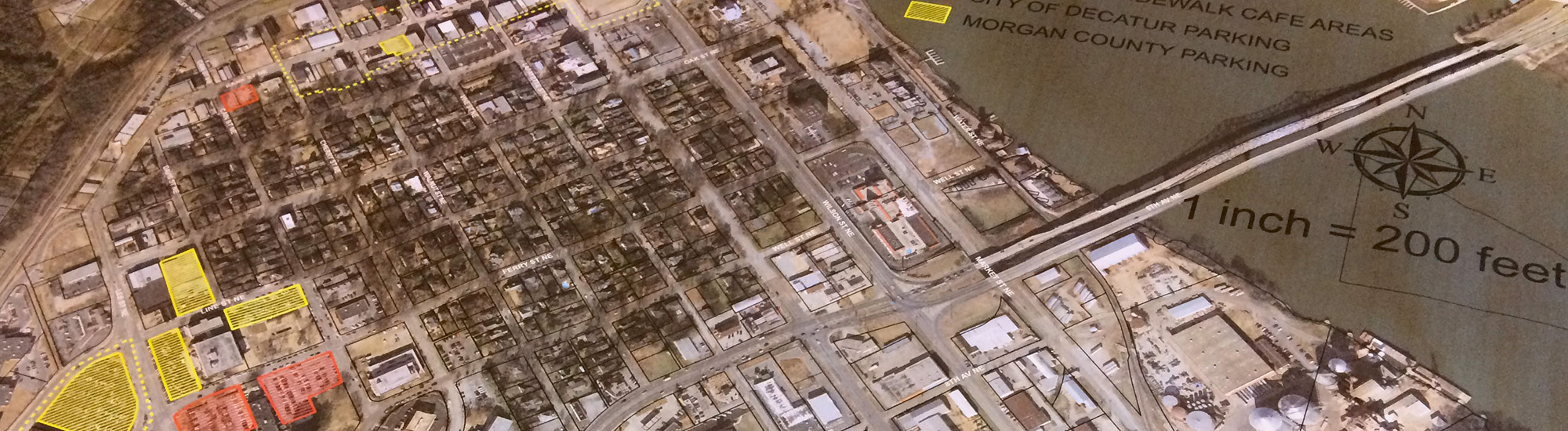
Click the maps for larger versions.
Map 1
Map 2
The 2010 Plan was developed and adopted on April 27, 1999 by the following citizens and elected officials:
City of Decatur Planning Commission
Lynn Fowler, Chairman
Philip Hastings, Council Representative
Peggy Tyler, Vice Chair
David Parks, Secretary
Lorenzo Jackson
Stephen Baggs
Myron Melton
Paul Taylor
Gil Aldrich
For Mayor
Julian Price, II
City Council
Jack Allen, President
Pat Woller, President Pro Tem
Philip Hastings
Billy Jackson
Mark Ray
Written and Compiled by PLANNING DEPARTMENT
Robert C. Walker, Jr., AICP, Director
Linda Barnhouse, Secretary
Hannah Pearson, Planning Technician
Steve Kelso, Planning Technician
Karen J. Smith, Planning Technician
Sue Murphree, Draftsperson
COPIES OF THE 2010 PLAN CAN BE FOUND AT THE WHEELER BASIN LIBRARY, EACH OF THE SCHOOLS IN THE DECATUR CITY SCHOOL SYSTEM, AND THE CHAMBER OF COMMERCE.
THE PLAN IS ALSO AVAILABLE FOR PURCHASE OR REVIEW IN THE CITY OF DECATUR PLANNING DEPARTMENT LOCATED IN CITY HALL AT 402 LEE STREET.
FOR ADDITIONAL INFORMATION ABOUT THE PLAN CONTACT THE DECATUR PLANNING DEPARTMENT AT (256) 351-7590 OR E-MAIL AT planning@ci.decatur.al.us